
Restren:Sattelite Wiesbaden Mainz.jpg

Myns an ragwel ma: 800 × 599 piksel. Klerderyow erel: 320 × 240 piksel | 640 × 479 piksel | 1,024 × 766 piksel | 1,280 × 958 piksel.
Restren wreydhek (1,280 × 958 piksel, myns an restren: 164 KB, eghen MIME: image/jpeg)
| Restren dhyworth Wikimedia Commons yw hebma. Yma diskwedhys a-woles derivadow dhyworth y folen deskrifans ena. | Mos dhe folen an restren war Wikimedia Commons |
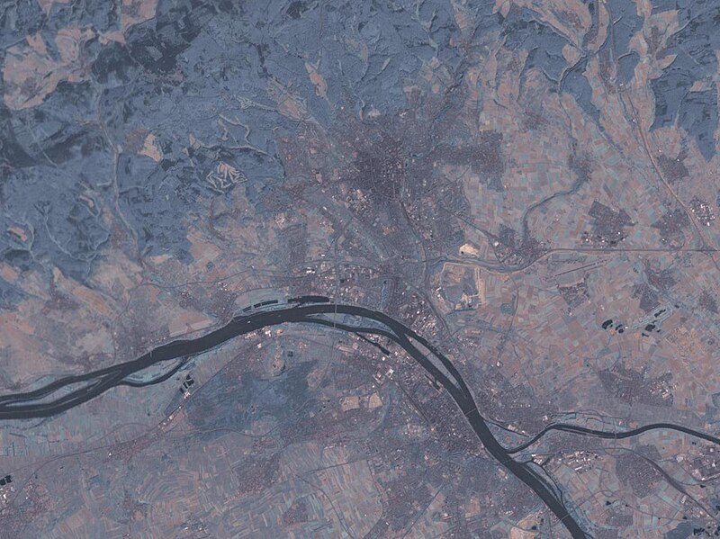
English: Satellite image of the cities Wiesbaden (north) and Mainz (south), and the confluence of the rivers Main and Rhine.
- Source: NASA World Wind - Used Filter: "Community: Landsat 7 (Visible Color)"
| Object location | | View this and other nearby images on: OpenStreetMap |
|---|
- License: "The Landsat Global Mosiac, Blue Marble, and the USGS raster maps and images are all Public Domain." (See http://www.worldwindcentral.com/wiki/Unofficial_FAQ#Are_images_on_World_Wind_copyrighted.3F ) - PD
| This image is in the public domain because it is a screenshot from NASA’s globe software World Wind using a public domain layer, such as Blue Marble, MODIS, Landsat, SRTM, USGS or GLOBE.
|
 |
Istori an restren
Klyckyewgh war dhedhyans/eur rag gweles an folen dell o an termyn na.
| Dedhyans/Eur | Skeusennik | Mynsow | Devnydhyer | Kampol | |
|---|---|---|---|---|---|
| a-lemmyn | 00:19, 20 Meurth 2005 | | 1,280 × 958 (164 KB) | Leipnizkeks | Sattelite image of Wiesbaden and Mainz - Source: NASA World Wind - Used Filter: "Community: Landsat 7 (Visible Color)" - License: "The Landsat Global Mosiac, Blue Marble, and the USGS raster maps and images are all Public Domain." (See http://www.worldwin |
Devnydh an restren
Nyns eus folen vyth owth usya an restren ma.
Devnydh ollvysel an restren
Yma an wikis erel a syw ow tevnydhya an restren ma:
- Devnydh war azb.wikipedia.org
- Devnydh war da.wikipedia.org
- Devnydh war en.wikipedia.org
- Devnydh war eu.wikipedia.org
- Devnydh war fr.wikipedia.org
- Devnydh war hu.wikipedia.org
- Devnydh war it.wikipedia.org
- Devnydh war ro.wikipedia.org
- Devnydh war tr.wikipedia.org
- Devnydh war uk.wikipedia.org
- Devnydh war yi.wikipedia.org
- Devnydh war zh.wikipedia.org