
Restren:Congregational chapel, Wolf's Castle-Cas Blaith - geograph.org.uk - 226292.jpg
Nyns eus klerder ughella kavadow.
Congregational_chapel,_Wolf's_Castle-Cas_Blaith_-_geograph.org.uk_-_226292.jpg (640 × 480 piksel, myns an restren: 71 KB, eghen MIME: image/jpeg)
| Restren dhyworth Wikimedia Commons yw hebma. Yma diskwedhys a-woles derivadow dhyworth y folen deskrifans ena. | Mos dhe folen an restren war Wikimedia Commons |
Berrskrif
| Deskrifans |
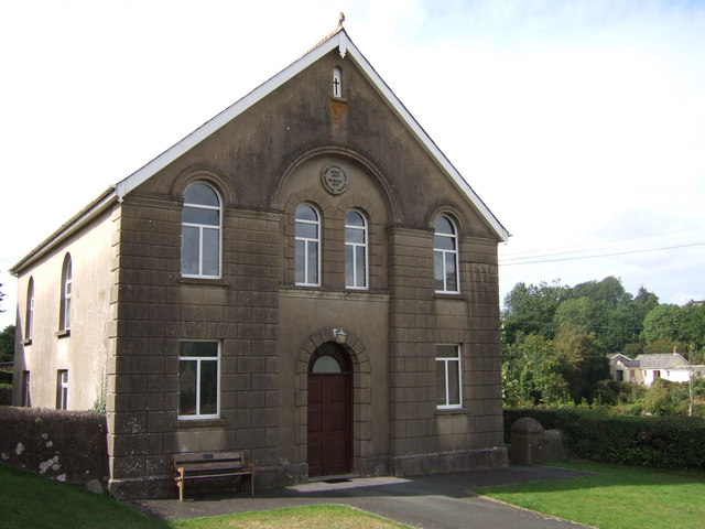
English: Congregational chapel, Wolf's Castle/Cas Blaith. Penybont Congregational chapel, dated 1907. It's by the old bridge pictured in the first Geograph, hence the name. |
| Dedhyans | |
| Pennfenten | From geograph.org.uk |
| Awtour | ceridwen |
| Askrifans (required by the license) | ceridwen / Congregational chapel, Wolf's Castle/Cas Blaith / |
| Camera location | | View this and other nearby images on: OpenStreetMap |
|---|
_heading:270.00&language=kw)
| Object location | | View this and other nearby images on: OpenStreetMap |
|---|
_heading:270.00&language=kw)
Leshyans

|
This image was taken from the Geograph project collection. See this photograph's page on the Geograph website for the photographer's contact details. The copyright on this image is owned by ceridwen and is licensed for reuse under the Creative Commons Attribution-ShareAlike 2.0 license.
|
This file is licensed under the Creative Commons Attribution-Share Alike 2.0 Generic license.
Askrifans: ceridwen
- Yma'n gwir dhywgh:
- a ranna – a dhasskrifa, lesranna ha treuskorra an ober
- a gemyska – a aswiwa an ober
- Yn-dann an ragselyow a syw:
- askrifans – Res yw dhywgh ri askrifans gwiw, provia kevren dhe'n lecyans, ha meneges mar peu chanjyow gwrys. Hwi a yll gul hemma yn fordh resonus a vynnowgh, mes ny yllir y wul yn fordh a broffo synser an lecyans dh'agas skoodhya po agas devnydh.
- ranna kehaval – Mar kwrewgh hwi chanjya, treusfurvya po drehevel war an ober ma, res yw dhywgh lesranna agas kevrohow yn-dann an keth lecyans hag an derowel, po lecyans kesplegadow.
Istori an restren
Klyckyewgh war dhedhyans/eur rag gweles an folen dell o an termyn na.
| Dedhyans/Eur | Skeusennik | Mynsow | Devnydhyer | Kampol | |
|---|---|---|---|---|---|
| a-lemmyn | 20:59, 31 Genver 2010 | | 640 × 480 (71 KB) | GeographBot | == {{int:filedesc}} == {{Information |description={{en|1=Congregational chapel, Wolf's Castle/Cas Blaith. Penybont Congregational chapel, dated 1907. It's by the old bridge pictured in the first Geograph, hence the name.}} |date=2006-08-26 |source=From [h |
Devnydh an restren
Yma an folen a syw owth usya an restren ma:
Devnydh ollvysel an restren
Yma an wikis erel a syw ow tevnydhya an restren ma:
- Devnydh war cy.wikipedia.org
- Devnydh war en.wikipedia.org
- Devnydh war eu.wikipedia.org
- Devnydh war fa.wikipedia.org
- Devnydh war gd.wikipedia.org