
Restren:Heron UAV operators.PNG

Myns an ragwel ma: 800 × 407 piksel. Klerderyow erel: 320 × 163 piksel | 640 × 325 piksel | 1,024 × 521 piksel | 1,280 × 651 piksel | 2,753 × 1,400 piksel.
Restren wreydhek (2,753 × 1,400 piksel, myns an restren: 91 KB, eghen MIME: image/png)
| Restren dhyworth Wikimedia Commons yw hebma. Yma diskwedhys a-woles derivadow dhyworth y folen deskrifans ena. | Mos dhe folen an restren war Wikimedia Commons |
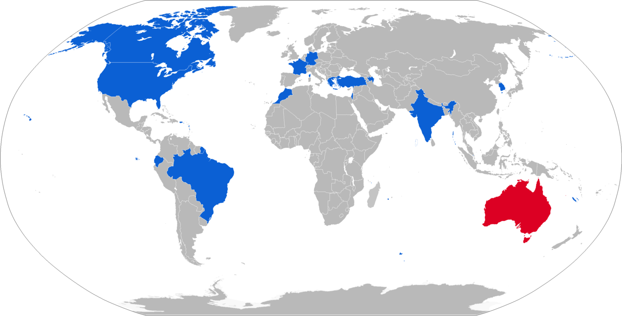
| Deskrifans | Map with military IAI Heron UAV operators in blue, with former operators in red and law enforcement operators in light blue | ||
| Dedhyans | |||
| Pennfenten | Own work, derivative of File:BlankMap-World-v8.png | ||
| Awtour | Natan Flayer | ||
| Kummyas (Dastevnydhya an restren ma) |
|

| This is a retouched picture, which means that it has been digitally altered from its original version. Modifications: Heron UAV operators colored in blue. The original can be viewed here: BlankMap-World.png:
|
| I, the copyright holder of this work, release this work into the public domain. This applies worldwide. In some countries this may not be legally possible; if so: I grant anyone the right to use this work for any purpose, without any conditions, unless such conditions are required by law. |
Original upload log
This image is a derivative work of the following images:
- File:BlankMap-World.png licensed with PD-user
- 2010-02-01T03:10:44Z R-41 1425x625 (31271 Bytes) Since Kosovo is shown as a disputed territory due to it being partially recognized, I have added other partially recognized territories.
Istori an restren
Klyckyewgh war dhedhyans/eur rag gweles an folen dell o an termyn na.
| Dedhyans/Eur | Skeusennik | Mynsow | Devnydhyer | Kampol | |
|---|---|---|---|---|---|
| a-lemmyn | 14:24, 15 Genver 2019 | | 2,753 × 1,400 (91 KB) | Jurryaany | Brazilian Air Force now also operating |
| 14:14, 7 Hwevrer 2018 |  | 2,753 × 1,400 (91 KB) | Jurryaany | Added Greece | |
| 15:45, 9 Est 2017 |  | 2,753 × 1,400 (91 KB) | Jurryaany | Updated map, moved it to new style. I'll edit the description on both the article and Wikimedia to reflect changes | |
| 16:53, 11 Kevardhu 2011 |  | 1,425 × 625 (55 KB) | NatanFlayer | 12-2011 | |
| 12:52, 10 Hwevrer 2010 |  | 1,425 × 625 (50 KB) | NatanFlayer | {{Information |Description=A blank map of the world as of 2008, with country outlines, for making country locator maps. This map uses the Robinson projection centered on the Greenwich Prime Meridian and includes various [[:en: |
Devnydh an restren
Nyns eus folen vyth owth usya an restren ma.
Devnydh ollvysel an restren
Yma an wikis erel a syw ow tevnydhya an restren ma:
- Devnydh war cs.wikipedia.org
- Devnydh war de.wikipedia.org
- Devnydh war es.wikipedia.org
- Devnydh war it.wikipedia.org
- Devnydh war ja.wikipedia.org
- Devnydh war ko.wikipedia.org
- Devnydh war ru.wikipedia.org
- Devnydh war sr.wikipedia.org