
Restren:Lobsterponds.jpg
Nyns eus klerder ughella kavadow.
Lobsterponds.jpg (640 × 480 piksel, myns an restren: 145 KB, eghen MIME: image/jpeg)
| Restren dhyworth Wikimedia Commons yw hebma. Yma diskwedhys a-woles derivadow dhyworth y folen deskrifans ena. | Mos dhe folen an restren war Wikimedia Commons |
Berrskrif
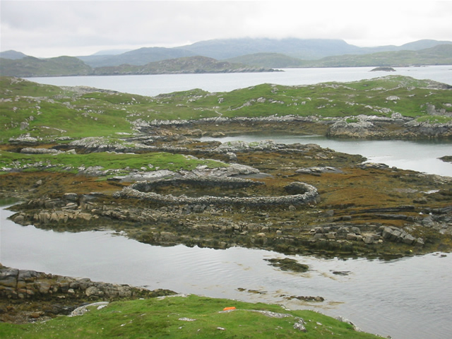
| Deskrifans |
w:Great Bernera, w:Outer Hebrides, Scotland. Lobster ponds Huge stone lobster ponds, as viewed from the footpath from Bhalasaigh to Bostadh. |
||
| Dedhyans | See image source page. | ||
| Pennfenten |
This image was taken from the Geograph project collection. See this photograph's page on the Geograph website for the photographer's contact details. The copyright on this image is owned by Graham Orriss and is licensed for reuse under the Creative Commons Attribution-ShareAlike 2.0 license.
This file is licensed under the Creative Commons Attribution-Share Alike 2.0 Generic license. Askrifans: Graham Orriss
|
||
| Awtour | See above. | ||
| Kummyas (Dastevnydhya an restren ma) |
See above. |

| Camera location | | View this and other nearby images on: OpenStreetMap |
|---|
| Object location | | View this and other nearby images on: OpenStreetMap |
|---|
_region:GB-GBN_heading:202.00&language=kw)
Leshyans
This file is licensed under the Creative Commons Attribution-Share Alike 2.0 Generic license.
- Yma'n gwir dhywgh:
- a ranna – a dhasskrifa, lesranna ha treuskorra an ober
- a gemyska – a aswiwa an ober
- Yn-dann an ragselyow a syw:
- askrifans – Res yw dhywgh ri askrifans gwiw, provia kevren dhe'n lecyans, ha meneges mar peu chanjyow gwrys. Hwi a yll gul hemma yn fordh resonus a vynnowgh, mes ny yllir y wul yn fordh a broffo synser an lecyans dh'agas skoodhya po agas devnydh.
- ranna kehaval – Mar kwrewgh hwi chanjya, treusfurvya po drehevel war an ober ma, res yw dhywgh lesranna agas kevrohow yn-dann an keth lecyans hag an derowel, po lecyans kesplegadow.
Istori an restren
Klyckyewgh war dhedhyans/eur rag gweles an folen dell o an termyn na.
| Dedhyans/Eur | Skeusennik | Mynsow | Devnydhyer | Kampol | |
|---|---|---|---|---|---|
| a-lemmyn | 12:51, 7 Gortheren 2008 | | 640 × 480 (145 KB) | MacRusgail | == Summary == {{Information| |Description=w:Great Bernera, w:Outer Hebrides, Scotland. Lobster ponds Huge stone lobster ponds, as viewed from the footpath from Bhalasaigh to Bostadh. |Source=This image was taken from the Geograph project c |
Devnydh an restren
Yma an folen a syw owth usya an restren ma:
Devnydh ollvysel an restren
Yma an wikis erel a syw ow tevnydhya an restren ma:
- Devnydh war ast.wikipedia.org
- Devnydh war br.wikipedia.org
- Devnydh war ca.wikipedia.org
- Devnydh war ceb.wikipedia.org
- Devnydh war cy.wikipedia.org
- Devnydh war da.wikipedia.org
- Devnydh war de.wikipedia.org
- Devnydh war de.wikivoyage.org
- Devnydh war en.wikipedia.org
- Devnydh war es.wikipedia.org
- Devnydh war eu.wikipedia.org
- Devnydh war ga.wikipedia.org
- Devnydh war gd.wikipedia.org
- Devnydh war gl.wikipedia.org
- Devnydh war gv.wikipedia.org
- Devnydh war it.wikipedia.org
- Devnydh war nds.wikipedia.org
- Devnydh war nl.wikipedia.org
- Devnydh war pl.wikipedia.org
- Devnydh war simple.wikipedia.org
- Devnydh war sv.wikipedia.org
- Devnydh war uk.wikipedia.org
- Devnydh war www.wikidata.org