
Restren:Brazil State Tocantins.svg

Restren wreydhek (Restren SVG, 702 × 687 piksel yn hanow, myns an restren: 676 KB)
| Restren dhyworth Wikimedia Commons yw hebma. Yma diskwedhys a-woles derivadow dhyworth y folen deskrifans ena. | Mos dhe folen an restren war Wikimedia Commons |

|
Standardization of derivative maps
Feel free to create derivations of this work, but if you want to illustrate a Wikipedia article with derivative works of this or similar maps of Brazil, please strictly follow the visual standard, nomenclature and classification already in use. All maps of Brazilian subdivisions are being adaptated or created in this way. We do not want to inhibit creativity but the pattern adopted here was presented and accepted by the Lusophone community and should be followed whenever possible. |
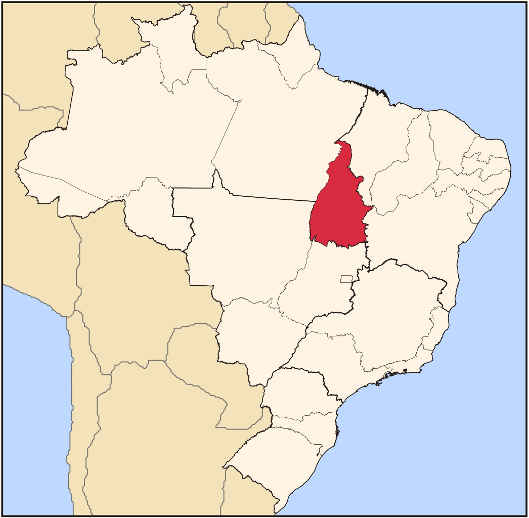
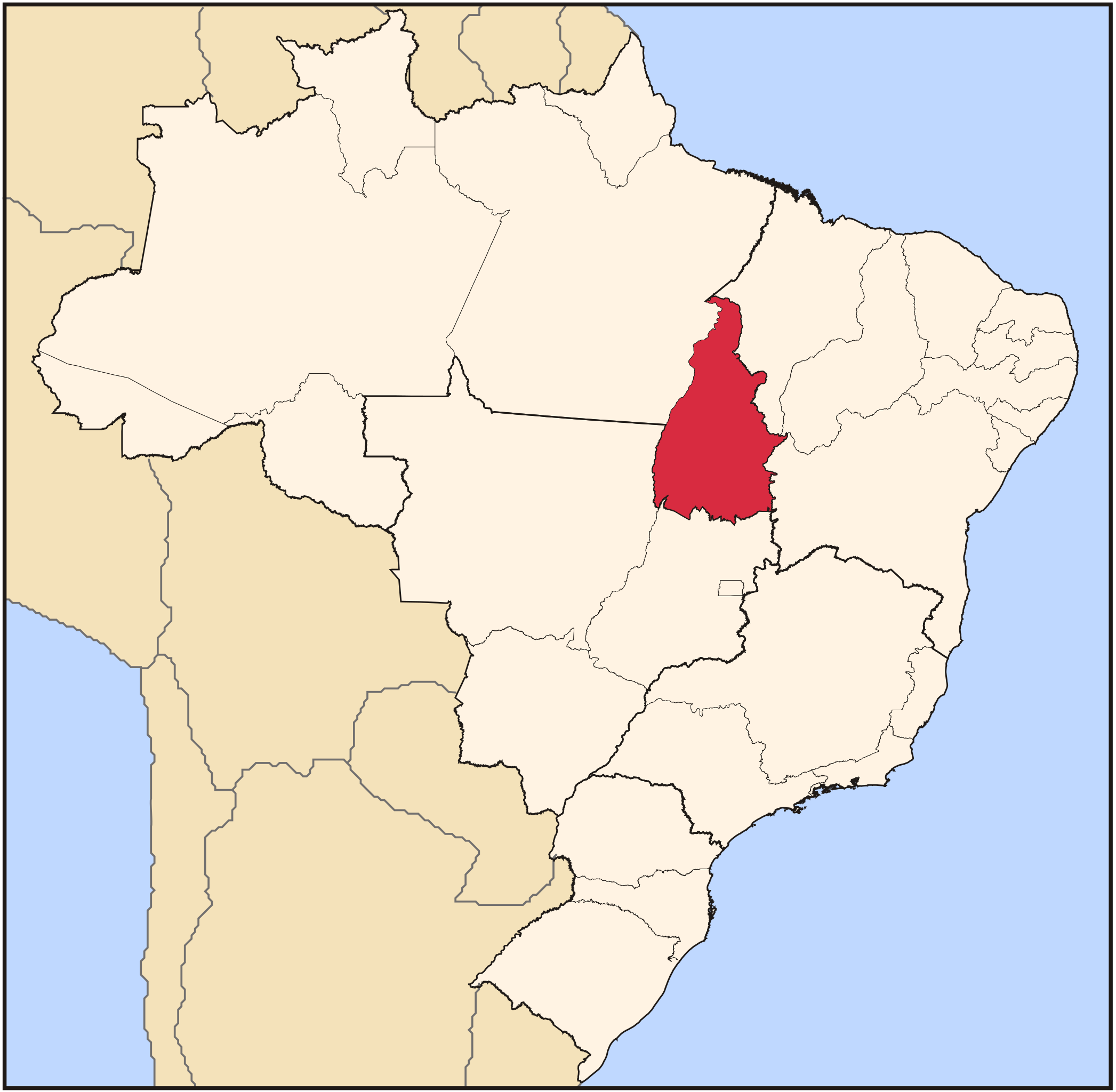
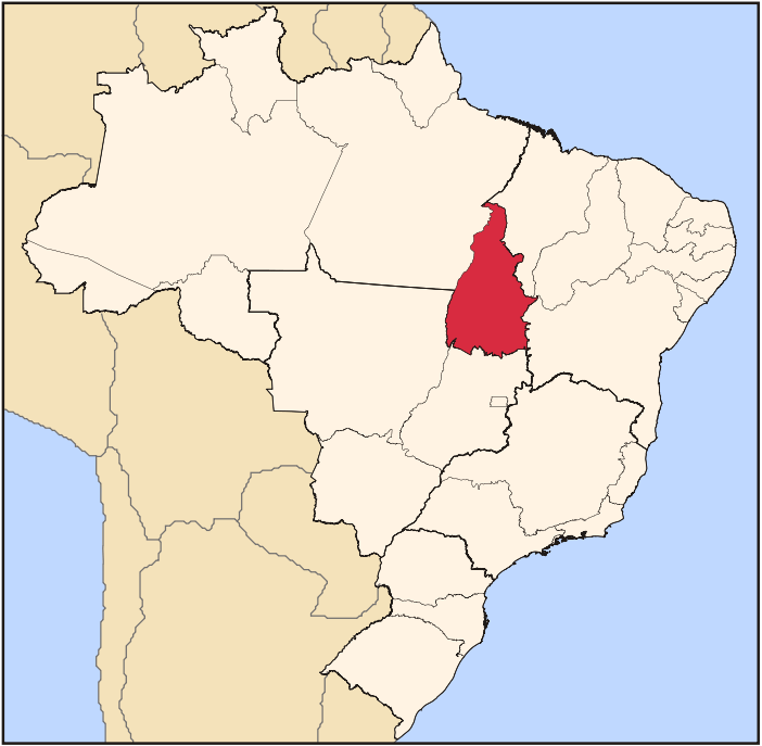
| Deskrifans | Map locator of Brazil's Tocantins state | ||||||||
| Dedhyans | |||||||||
| Pennfenten | Ober honan | ||||||||
| Awtour | Raphael Lorenzeto de Abreu | ||||||||
| Kummyas (Dastevnydhya an restren ma) |
I, the copyright holder of this work, hereby publish it under the following licenses:
This file is licensed under the Creative Commons Attribution 2.5 Generic license.
You may select the license of your choice. |

Istori an restren
Klyckyewgh war dhedhyans/eur rag gweles an folen dell o an termyn na.
| Dedhyans/Eur | Skeusennik | Mynsow | Devnydhyer | Kampol | |
|---|---|---|---|---|---|
| a-lemmyn | 03:18, 3 Metheven 2006 | | 702 × 687 (676 KB) | Raphael.lorenzeto | |
| 02:16, 22 Ebrel 2006 |  | 702 × 687 (448 KB) | Raphael.lorenzeto | {{Information| |Description=Map locator of Brazil's Tocantins state |Source=own work |Date=April, 21 2006 |Author=Raphael Lorenzeto de Abreu |Permission={{self2|GFDL|cc-by-2.5}} |other_versions= }} Category:Maps of Brazil |
Devnydh an restren
Yma an folen a syw owth usya an restren ma:
Devnydh ollvysel an restren
Yma an wikis erel a syw ow tevnydhya an restren ma:
- Devnydh war af.wikipedia.org
- Devnydh war arz.wikipedia.org
- Devnydh war bg.wikipedia.org
- Devnydh war bpy.wikipedia.org
- Devnydh war da.wikipedia.org
- Devnydh war de.wikipedia.org
- Devnydh war dz.wikipedia.org
- Devnydh war en.wikipedia.org
- Tocantins
- Natividade, Tocantins
- Palmas, Tocantins
- Araguaína
- Paranã
- List of municipalities in Tocantins
- Porto Nacional
- Almas, Tocantins
- Alvorada, Tocantins
- Ananás, Tocantins
- Angico
- Aparecida do Rio Negro
- Aragominas
- Araguacema
- Araguaçu
- Araguanã, Tocantins
- Araguatins
- Arapoema
- Arraias
- Augustinópolis
- Aurora do Tocantins
- Axixá do Tocantins
- Babaçulândia
- Bandeirantes do Tocantins
- Barra do Ouro
- Barrolândia
- Bernardo Sayão
- Bom Jesus do Tocantins, Tocantins
- Brasilândia do Tocantins
- Brejinho de Nazaré
- Buriti do Tocantins
- Cachoeirinha, Tocantins
- Campos Lindos
- Cariri do Tocantins
- Carmolândia
- Carrasco Bonito
- Caseara
- Centenário, Tocantins
- Chapada de Areia
Gweles devnydh ollvysel moy a'n restren ma.